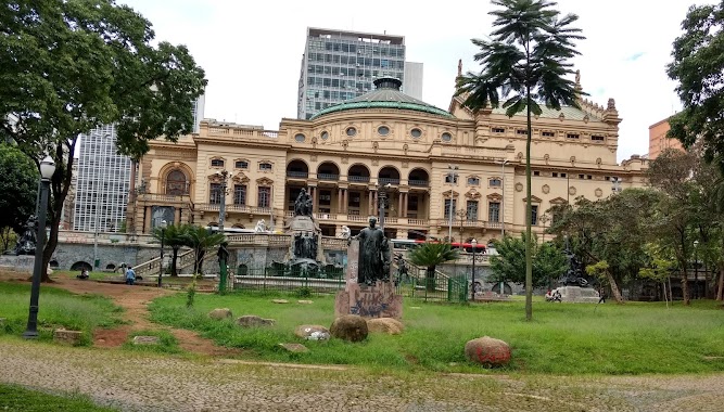
Subway station nearby Brigadeiro
Coronavirus disease (COVID-19) Situation
confirmed cases
38743918
deaths
711380
Brazil
Subway station nearby Brigadeiro
Brigadeiro
447, Avenida Paulista, 01310-000, São Paulo, São Paulo, BR Brasilien
contacts phone
:
+55
Latitude:
-23.5682954
, Longitude:
-46.6479653
larger map & directions
read more
nearest Subway station
787 m
Trianon - Masp
Av. Paulista - Jardins, São Paulo
Subway station
read more
822 m
Vergueiro Metro Station
Rua Vergueiro, 790 - Liberdade, São Paulo
Subway station
read more
822 m
Estación Vergueiro
Rua Vergueiro, 790 - Liberdade, São Paulo
Subway station
read more
1.077 km
Metrô Paraíso
Liberdade, São Paulo
Subway station
read more
1.184 km
São Joaquim
São Paulo
Subway station
read more
1.753 km
Subway Ana Rosa
Vila Mariana, São Paulo
Subway station
read more
1.766 km
Consolação
Avenida Paulista, 2163 - Cerqueira César, São Paulo
Subway station
read more
1.915 km
Liberdade
Praça da Liberdade, 133 - Liberdade, São Paulo
Subway station
read more
2.078 km
Companhia do Metropolitano de São Paulo Metro
São Paulo
Subway station
read more
2.187 km
Higienópolis-Mackenzie
Brazil
Subway station
read more
2.352 km
Higienopolis - Mackezie
Rua da Consolação - Consolação, São Paulo
Subway station
read more
2.432 km
Estação Anhangabaú
Rua Formosa - República, São Paulo
Subway station
read more
2.519 km
Sé Station
Praça da Sé, São Paulo
Subway station
read more
2.519 km
Sé
Praça da Sé, São Paulo
Subway station
read more
2.579 km
Metrô Oscar Freire
Avenida Rebouças, 1089 - Cerqueira César, São Paulo
Subway station
read more
2.631 km
República
Brazil
Subway station
read more
2.635 km
Metro Itaquera
Rua São Bento, 200 - Centro, São Paulo
Subway station
read more
2.647 km
Metro Arquitetos Associados
Rua Gal Jardim, 703 cj 21 - Vila Buarque, São Paulo
Subway station
read more
2.733 km
Vila Mariana
Vila Mariana, São Paulo
Subway station
read more
2.783 km
República
Praça da República, 299 - República, São Paulo
Subway station
read more
2.794 km
Clínicas
Cerqueira César, São Paulo
Subway station
read more
3.01 km
São Bento
Largo de São Bento, 109 - Centro, São Paulo
Subway station
read more
3.053 km
Pedro II
Brás, São Paulo
Subway station
read more
3.25 km
Chácara Klabin
Brazil
Subway station
read more
4.998 km
Vila Madalena
Rua Doutor Paulo Vieira, 010 - Sumarezinho, São Paulo
Subway station
read more
📑
all categories
Accounting
Administrative area level 1
Administrative area level 2
Airport
Amusement park
Aquarium
Art gallery
Atm
Bakery
Bank
Bar
Beauty salon
Bicycle store
Book store
Bowling alley
Bus station
Cafe
Campground
Car dealer
Car rental
Car repair
Car wash
Casino
Cemetery
Church
City hall
Clothing store
Colloquial area
Convenience store
Courthouse
Dentist
Department store
Doctor
Electrician
Electronics store
Embassy
Establishment
Finance
Fire station
Florist
Food
Funeral home
Furniture store
Gas station
General contractor
Grocery or supermarket
Gym
Hair care
Hardware store
Health
Hindu Temple
Home goods store
Hospital
Insurance agency
Intersection
Jewelry store
Laundry
Lawyer
Library
Light rail station
Liquor store
Local government office
Locality
Locksmith
Lodging
Meal delivery
Meal takeaway
Mosque
Movie rental
Movie theater
Moving company
Museum
Natural feature
Neighborhood
Night club
Painter
Park
Parking
Pet store
Pharmacy
Physiotherapist
Place of worship
Plumber
Point of interest
Police
Political
Post office
Premise
Real estate agency
Restaurant
Roofing contractor
Route
Rv park, camping
School
Shoe store
Shopping mall
Spa
Stadium
Storage
Store
Subpremise
Subway station
Supermarket
Synagogue
Taxi stand
Train station
Transit station
Travel agency
University
Veterinary care
Zoo
administrative area level 4
sublocality level 1
sublocality level 2
sublocality level 3
sublocality level 4
↑